EEA and Norway Grants 2009–2014
Press CTRL+ to zoom in and CTRL- to zoom out.
Project title:
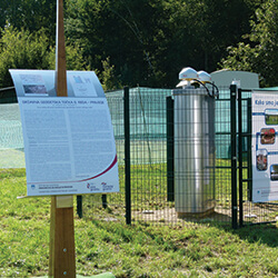
Modernization of Spatial Data Infrastructure to Reduce Risks and Impacts of Floods
Project acronym:
Modernization of Spatial Data Infrastructure
Project Promoter:
The Surveying and Mapping Authority of the Republic of Slovenia
Project Partners:
Partner 1: Norwegian Mapping Authority (Statens kartverk)
Partner 2: The National Land Survey of Iceland (Landmælingar Íslands)
Project duration:
25.07.2013 - 30.11.2016
Total eligible costs of the project:
3,060,000 EUR
Project grant:
2,085,882 EUR
Programme Area:
Environmental Monitoring and Integrated Planning and Control
General objective of the project:
Modernization of infrastructures for spatial information to boost governance and reducing the risks and impacts floods in accordance with inspire implementing rules.
Project summary:
The modernisation of a basic geodetic reference system – vertical component is a necessary and unavoidable condition for any flood related measure and to all spatial related environmental data. The INSPIRE infrastructure for spatial information will assist policy-making in relation to activities that have a direct impact on space and environment. The project will modernize the infrastructure for spatial information in Slovenia, with the aim of supporting water management, reducing the risk and impact of floods, facilitating water management and increasing the consistency of the data to the requirements of the INSPIRE directive. The primary target groups are the public administration, land surveyors, hydro technical specialists, hydrologists and spatial planners. Bilateral relations will be facilitated through networking and exchange of good practices, technology and experience among the project promoters and project partners.